Thursday, June 30, 2016

The Northshore road

A view from Northshore road, LMNRA, NV
On the way back from Overton we stopped a few places to enjoy the amazing scenery down the Northshore road. Maybe because it's just the back yard of Vegas, the Lake Mead NRA (National Recreational Area, nothin' to do with rifles, TYVM) doesn't get much credit for the lovely and dramatic vistas it affords - perhaps not as much as it should.

What in the Sam Hill?
Hamblin Cleopatra Mountain, LMNRA, NV
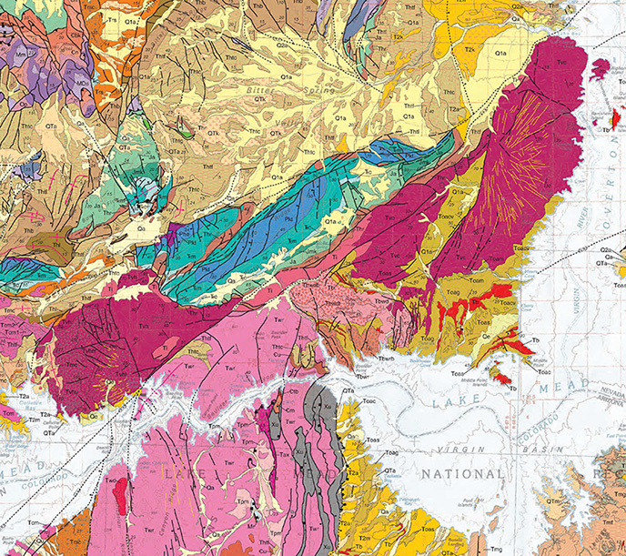
The landscape is a long history of tortured rock, with upturned layers, basalt scattered broadcast, and eroded shapes. There is an old volcano that's been torn in half by a big old fault. You drive past one half of a mountain, and then ten miles later the other half. (Or - one day! - hike it.)

If your taste runs to red sandstone, there are softly rounded outcrops that the road winds briefly through (trailheads here too), as well as tall temples out on the plain. (At first glance they look like ruins, but made by wind and water, not by us.)

A number of old mines can be cautiously investigated - though many of the roads and trails need a high clearance vehicle to follow washes up into the hills or towards the lake. There are warm springs where you can bathe with nibbly fish. Slot canyons. A valley ringed about with the beautiful red Aztec sandstone that was once part of the Jurassic sand dunes that covered much of the southwest. The undrowned ghost town of St Thomas, whose ruins have been exposed by the receding of Lake Mead ( ... which, alas, sounds more fun than it is. Perhaps better with the charm of distance still on it. Come and visit and I promise to not take you there! Unless on the way to the salt mines.)

You get hints of all this from the road, in the tops of palm trees over a low rise to the west, a flash of curved red rock far back between a break in the hills, or a flat sandy wash that curves invitingly away from the sun. We've barely scratched the surface, and almost I despair - there is so much to explore we'll never feel finished here.

Guess I'll stop trying to drink the ocean or eat the whole desert. One day.

Wednesday, June 29, 2016

Butterfly Basket and the salt of the Lost City


On Saturday we took a drive up the North Shore road of Lake Mead to Overton, resolutely not stopping for no matter how lovely a view, to go to the Lost City Museum. (It looks closed because a) it's summer and you keep the door closed lest all the heat of Nevada creep inside and b) it was closed by the time we left/took the photo.)

Perhaps not many people realise that the ancient Puebloans settled this far west and had lived here for over a thousand years when Columbus's umpty-great-grandmother was hardly a twinkle in her mother's eye. The Lost City, the Pueblo Grande de Nevada, was a complex of villages and roads stretched over 25 or 30 miles in Moapa Valley, inhabited between about 300 BC and 1150 AD. After being "discovered" by Anglos in the 1920s, it acquired its evocative English name to satisfy the excitable newspaperfolks of the time. Some of it was excavated in the 20s and then more hastily while the Hoover Dam was a-building. Much of it is probably still to find under farmhouses or fields in the valley of the Muddy River.

Fragments of pottery at Lost City Museum, Overton NV
The ancient Puebloans, sometimes also known as Anasazi, made beautiful ceramics of just renown, which a visitor can see in poignant scraps and rare recovered or reconstructed whole vessels. (I first heard of Anasazi pottery from an English art historian I once knew. I am glad I lived to see it here, where it came from - and wish the same for him.) They traded far and wide - there is lovely abalone shell jewellery in the museum. They raised, hunted and gathered food; and mined turquoise, ochre, and salt - for use and trade.

Salt, in chunks as large as two fists, in great discs a yard across. Gemmy salt, as clear as glass. (Early Anglo settlers, over eight hundred years afterwards, which is over a hundred years ago now, experimented with it for window panes.) The ancient Puebloans traded it at least as far away as Arizona, and maybe further. Salt's even more fragile than pottery, much harder to trace. One good flood and it's washed away. One flood of biblical proportions has done for the ancient salt mine, dating from Christ's time, that was a source of wealth, probably convenience, and - I'm sure - delight to the people who lived here in the pit houses and multi-roomed adobe buildings all that time ago.

That flood was the rising of Lake Mead in the 1930s. Although the water has receded now through the ferocious thirst of the southwest's farms and market gardens, the old salt tunnels are gone, eroded and collapsed by decades of inundation. You can still hike to the site. It's about four hours' walking east of the road in the Lake Mead National Recreational Area. The salt tastes salty, the man at the museum told me sheepishly (it's in a National Rec Area, you're probably not really supposed even to taste it ...) but the caverns, he added sadly, are gone. I can almost picture the crystalline caves and corridors - there are perhaps still a few people alive who have seen them face to face.


But the museum is not only about the Pueblo Grande or the ancient mines - although the original CCC built adobe museum has been expanded to surround an actual ruin, partly excavated.
Butterfly basket from Pahrump area, NV


There are also displays on natural history and local climate change. Likewise, other eras of history of the area and region - Mormon settlement in the Moapa valley; drowned St Thomas town; railways in the Meadow Valley up to Caliente (note to self: go to Elgin); the work of the CCC in the Lake Mead area; the exquisite basketwork of Paiute artists from the Pahrump area west of Las Vegas over the Spring Mountains.


On rather a different cultural note, it has about the best t-shirts anywhere if you happen to like gold paint and symmetrical or stylised designs with Southwest motifs. The first time we were there, Simon bought a magnificent pony shirt with gold everywhere, and the other day, I picked up a hummingbird and cactus flower sort of mandala ish design.

And, happily, they also had salt ... and I feel it would be ungracious to complain that it was not glass-clear or from an ancient mine.

More reading on the fascinating Lost City in this great book review: http://nevadamagazine.com/home/archives/nevadas-lost-city/


Monday, June 27, 2016

Stealth trilobites and a playa drive

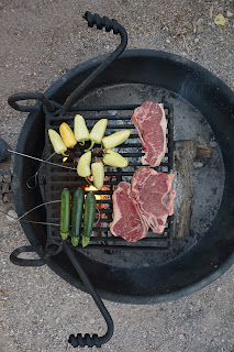
But first, we must set fire to all the things.

The moon was properly full - the Teen had a fantastic time popping corn on the campfire, making s'mores, etc, complaining about the smoke, etc. (Was pretty smoky, must admit.)

The next morning, we packed up and drove along 93 west to Oak Spring Summit, where you can go and dig fossils out of the ground - in theory, anyway.

The trilobite site was a good excuse to take Harry down a dirt road. It's clearly an ATV/OHV trail, so we found a place to turn around. On the way back up we re-passed a patch of golden yellow shale - stopped and looked but didn't find any fossils.

So, much like the remainder of the stop, really. We found a few impressions in rock where someone else had split the shale and found a fossil - some of them are very beautiful. But none of our own, not one: zip, nil, and nada. However, even without finding any fossils, I thought that digging down into the ground and opening layers of rock that have been sitting there for 500 million years (since the lower Cambrian) was quite cool. Sitting or lying on the rocks was like being on an electric blanket, and I had to remember to keep drinking. I'd like to go back in a cooler season with more time, more tools, and companions who are willing to stay for a few hours (the Teen wasn't).

Island of pseudonormal in the middle of a vast arid solitude.
in foreground on picnic basket:
Desert S'mores (chocolate melted onto graham crackers)

Next, we drove down to Delamar Playa again so the Teen could have a look. We improvised a picnic (thanks Harry for the shade). To aid our digestion, we let the Teen have his first drive, still out on the playa. There wasn't a soul - just us three careering about in Harry and the wind and the dust devils.

Then down through Overton and the amazing colours and varied geology of the North Shore road along Lake Mead, and home to a fiery summer day.

Coming back into Henderson.
We missed the photo of 120 F because I wouldn't take a pic while driving :)

Itinerary

Sunday: To Caliente, turn west on 93 to Oak Spring Trilobite Area. 93 west to Delamar. Dirt road to Delamar Playa, Alamo Canyon Road to Alamo, 93 south to Coyote Springs, 168 southeast to Moapa and Glendale, I15 north and 169 to Overton, 167, 564, 215 to Henderson.

Friday, June 24, 2016

and then I saw this flower

I'm usually the one saying "Oh no we should really clean the kitchen this weekend". So even though it was a really cool, wet spring, which means a bumper year for desert wildflowers, I was exceptionally slow to warm up to the idea. Of course I did, eventually, and then in my customary fashion created a series of completely artificial and absurd tasks for myself ... I want a picture of this kind of flower. Okay, now this kind. A close-up. A landscape. Standing on one leg ...

Now the procedure is to take a close-up, a bigger shot of the plant so I can see its habits and structure, and maybe remind myself just where we were, and then when back at home try and match it up with one of the wildflower books and leaflets, or, as a last resort, online (cheating, cos it's too easy.)

And this was the first one that I was struck by, on the way out to Death Valley in April with a bran new camera in my lap. (It's a white Sony α5000. Is nice, like sputnik.) The hilarious part is that it's one of the most common wildflowers (this year, anyway) in these parts ... we've since seen fields of it in Southern Nevada, Mojave, Arizona, Utah. But when I first saw it, I didn't even know its name, and it was only just coming into flower here and there. (A bit like my knowledge of desert flowers, really, which is still only coming into flower here and there.)

On Black Canyon Rd, Mojave Nat'l Preserve
Desert globemallow. (Sphaeralcea ambigua - urk, really?) is the orange jewel broadcast on the side of highways, freeways, byways in late spring and early summer. It seems to like a bit more elevation or moisture than creosote, from what I've seen. It's not noticeably scented. The leaves are almost rough to the touch. They look quite like pelargonium leaves and have the same fleshiness to them.


The flowers are vaguely like poppies.
I don't know that it's specifically good for anything other than being lovely. (Well, I looked it up and you can use it like other mallows and that was fantastic because I found this site while doing that, which also reminded me I need to get out my Art Stix and notebook and draw flowers again.)

But it's so good at being lovely, and anyway I'm no herbalist, so the mucilaginous qualities of its roots are probably going to remain undisturbed by me for now. (Famous last words, right?)

Some other Anglo names are apricot mallow, desert mallow, globe-mallow, sore-eye poppy.

Thursday, June 23, 2016

No one even knew his name: Pioche, NV

At Boot Hill Cemetery, Pioche, the graves
are decorated with boots, shoes, and flowers.
That's Pee-oatch, not Pee-osh. I wonder what Monsieur Pioche would think? Guess as long as that ore keeps being dug out and trucked off, maybe he wouldn't be too bothered.

They certainly pulled a lot of money out of the ground around here, and probably more than the $25 million of silver that showed up on the reports.

Pioche was a pretty rough town even by Western standards, back in the day. They say that of the first 76 deaths in the town, 75 were from unnatural causes. Or something like that. The precise story varies. The several cemeteries tell a tale ... this is the smallest and most rustic, and the only one we went to so far.

"Shot by a coward
as he worked his claim
No one even knew his name
Pioche Nev" 
Visiting the grave sites, lead poisoning seems to be right up there: "shot by officers 5 times", "shot while working his claim", "shot by in back 5 times from ambush". They buried these men with their boots on, and they say that's why it's called Boot Hill cemetery (one of many).

This is what they had in mind when they called it the Wild West, I suppose. It doesn't sound like the most fun a person can have (for illustration, watch an episode or two of Deadwood.) Makes for sobering visiting, and a half-disbelieving sense of unreality yet again.

Apart from a dodgy history and a lot of graves, Pioche is a quaint little town insinuated into the side of a steep hill and spreading down its slopes most of the way to the 93. Strictly, it's an unincorporated community. This surprised me as it's also the county seat of Lincoln County. Off Main St, the roads are narrow and twisty - luckily we didn't meet any oncoming traffic. Pioche has a variety of gritty historic buildings, including, notably, the courthouse that cost a million dollars, which you'll have to click through to or wait til next time we go because we, driving around bemused, clean forgot to photograph.

Aerial tram


If you like industrial ruins (yes! I do!), Pioche does have a fantastic aerial tram, mostly intact but out of service now. It dates to the 1920s or so, and is complete with buckets and 'danger' signs.

We spent a while poking round an antique store, and I bought three 1920s to 40s surveyor's notebooks detailing survey records of a nearby silver mine - mainly because I like the books themselves, oh such wabi-sabi, full of obscure hand-written pencil notes.

The Bristol mine can be seen, and its associated ghost town too, (if the landowner grants permission - it's still owned by the Company) but it sounds like it's an off road adventure so it goes on the someday list for now.


Back to Kershaw Ryan to cool our feet in the wading pool,
then for a quiet evening with a campfire.

Itinerary

Saturday: North on 93. Turn onto 321 and to Pioche. Northeast on 321 to rejoin 93. 93 south, back to Caliente and Kershaw-Ryan

Wednesday, June 22, 2016

Cathedral Gorgeous


Q. What if nature played water games in a clayey old lake bed for thousands of years?
A. Cathedral Gorge State Park.


The old lake sediment must be exactly the perfect consistency - soft enough to cut through, sticky enough to hold its shape. Runaway runoff has carved and is carving an astounding succession of crannies, caves, niches and slots into the previously solid accumulation of ancient lake sediment. If you've ever seen Bryce Canyon, with its hoodoos, or Cedar Breaks, both formed by wind erosion and repeated freeze-thaw cycles on sandstone, the similarity is striking.


But the scale is completely different. The shapes recall Hindu carved walls, classical columns, nesting ledges of a thousand birds, and you can reach out and touch them, practically hold them in your hand.


The upper surface is no more than 50 feet above, much less in most places. The close quarters lead to amazing keyholes of sky and effects of sunlight filtering down over the intricate surfaces. And, much photography.


The Grand Canyon kind of does your head in but is hard to intimately connect with, whereas Zion rears above you, you're among it, literally inside it, and it is more humanly touching because your brain can comprehend the scope.


In the same way, some slots in Cathedral Gorge are too small to get through, and we were brushed either side with dirt by the time we came out - but the smaller scale, if anything, made us even more wide-eyed with wonder. (Yeah, even the teen. Fist pump! We casually - nah the truth is we pointedly - mentioned that we do stuff this cool practically every time we go away. The education continues.)

Also, it was fairly warm out there (112/44) but in among the crevices there were constant out-sighings of cool air. How can that be? And even knowing how, I shake my head. It does not seem any less amazing.


CCC water tower
The site is adorned by a few old CCC buildings: a ramada, a water tower and a very charming outhouse that is no longer accepting donations (there's one of those at Kershaw-Ryan, too) - and there is camping there too, perhaps for a cooler season.


And they had the best mud ever. I have seen mud dried into curved tiles before. This is the first time I've ever seen it curled into a fringe.


Miller Point overlook
Across the highway from the park entrance is the ghost town of Bullionville - for next time. (We were already saying 'next time' by then.) For now, we turned north on 93 towards Pioche, stopping at the Miller Point Overlook to see Cathedral Gorge from above.

Itinerary


Saturday: 317 to Caliente, turn northeast on 93. Through Panaca junction, to Cathedral Gorge State Park ...


Lincoln County rematch


John Muir once said "The mountains are calling and I must go." I hear it a little differently ... it's the desert that calls. (This is a mystery to me. More on it anon.) For now, the desert was calling us and we had even managed to persuade the teen to go, so on Friday we packed up Harry's boot good and tight with a thrilling array of camping equipment, shut the cats in with all their necessities, and got on the freeway north. We had unfinished business with Lincoln County.

Arrow Canyon Range NV:
The dark grey band makes the fault lines conspicuous even at 70 mph.
And look! Moon!
The second time up a highway can be a little as a song that was sung or a story told. That is to say, it can be a bit tedious or it can catch your breath like it did the first time.

Having fallen for Nevada's stripy hills and mountains, it's never less than a quiet pleasure for me to drive through its valleys and see those improbable blocks of rock slowly sinking into their blankets of sand and sediment.

And on this particular drive, there's a stretch of 93 after the road turns north for the first time and the valley is bounded on the east by the spectacular Arrow Canyon range, gorgeous with horizontal bands of colour in the early evening light. The moon already risen, and that crazy Nevada blue sky ...

Traffic had slowed us down a bit leaving LV, so instead of enjoying the sunset at our campsite, we enjoyed it with the almost full moon over the Delamar Valley as we passed through.

Kershaw-Ryan State Park has a modest first-in, best-dressed campground. It was about a third full when we arrived and made a couple of circuits in the gathering twilight - looking and calculating for daytime shade. We pitched the tents hurriedly by lamp- and moon-light, which definitely makes it sound more romantic and enjoyable than it was, then sat down to a supper of cold baked chicken and herbed sweet potato salad. (Somewhere during this period the mosquitoes discovered me. I'm not sure why I got the 'most delicious' vote ... anyway, the welts have mostly gone now.) We didn't stay up late to watch the stars, although we did take some time to enjoy the cliffs by moonlight. (Also, there was a Welcome Frog or at least a resident frog by the ablutions block and I saw it eat a bug, just like that. It is these small things that make me happy.) A campfire would wait for Saturday night.

Jacket keeps it warm :)
I was up bright and early at about 4:30 on Saturday morning. The sky was already lightening and it
felt cold (well, I say cold. It was probably 16 or 17 C.) I got the coffee going and enjoyed the sunrise, painting colour everywhere. The campground, in the lower part of the canyon, is about 20 years old. (It was rebuilt after its predecessor was washed out by flash floods.) On either side the ash-flow tuff cliffs catch the light beautifully at every hour of day.

Stove and coffeepot did their mighty work; yoghurt and cereal (or thereabouts) for breakfast. Then Simon and I went for a walk up the canyon while the teen stayed in camp reading.

I'm still nursing plantar fasciitis (or fascists, as autocorrect would have you believe) so we took the car up a mile or so to the visitor parking and walked from there. The canyon overlook walk winds up through gardens and pleasure-grounds (I think that's the right word when there's a wading pool and a terrain for playing horse-shoes?), past 40 foot high thickets of wild grape. The trail then divides, into or across a wash. We went across and up through juniper scrub, the trail twisting back on itself to traverse layers of rock to the mesa above, which afforded a view over the canyon to the valley beyond and even a glimpse of the Union Pacific line.

We saw deer or maybe bighorn sheep tracks and, more excitingly, big cat tracks - could have been bobcat or mountain lion, hard to tell. The prints were about 3 inches wide, and some of them were very clear, but too hard to photograph. 

To return, we scrambled down into the wash and followed the riverbed. Whatever big cat had been up to the summit had also been down in the wash - possibly to drink, possibly to hunt. We skirted a bulrush-fringed pool guarded by a tarantula hawk wasp (which is, alone, a sufficient argument against a benevolent creator) and scrambled down a couple of small dry waterfalls. Then I came round a corner and saw a snake - the first one I've seen alive and face to face in the wild here, as opposed to watching its flickering back depart. It tasted the air and high-tailed it into the grasses and low shrubs. I'm pretty sure it was a mountain gartersnake, most of a metre long, with handsome pale lemon and dark green markings.

Back at camp, it was time for a nap before we headed out for the afternoon.

Itinerary

Friday: From LV, I15 then 93 through Coyote Springs, Alamo, ET junction, and northeast past Delamar to Caliente. Turn south on 317 to Kershaw-Ryan State Park.
Saturday: Kershaw-Ryan State Park ...


Friday, June 17, 2016

My wonderful stove

My wonderful stove was beautifully upcycled from an aluminium can. It runs on isopropyl alcohol and can boil a litre of water in less than ten minutes - when there's snow on the ground. It packs into a tiny plastic box. (Even with its separate windshield, it takes up less room than a barbecue lighter.) It's shiny, though not as shiny as it used to be.  
The little stones in the measuring cup are for levelling it on rough ground. The medicine measuring cup came with, but I only use it for keeping the stones away from the walls of the stove, since there are measuring markings on the inside of the stove anyway.

To use it, you pour in the alcohol (I buy Heet antifreeze in the yellow bottle), set it alight, wait until the side jets start burning, and set the pot directly on the top. This chokes the flame from the main large round cavity, and paradoxically provides better fuel efficiency. It does best with a pot that's at least 5 inches across - our coffee pot is borderline too small. 


An early outing was at Cedar Pockets (great name!) at Christmas time, as we stopped for a brew-up. Yes, that's correct, as kettles go, it is the coolest in the world, closeup below*.


And later the same day, made soup for lunch at Pipe Spring (another great name). I managed without gloves but there were flurries of snow while we were there. (In case you're wondering, it's a turkey and avocado soup.)
I bought the stove from Mechanic Mike on ebay and I heartily recommend both the stove itself and the seller. Here's his video.


*So is the matching coffee pot. These guys will probably get their own post some time. 
 

Wednesday, June 15, 2016

Two books of Western stories: 'Arizona Nights' and 'Riding for the Brand'

Part of the fun of moving here has been immersing myself in a whole culture that I'd pretty much actively avoided before. Yeah, this is cowboy-a-go-go-land (hat tip to Louise Rennison), it's the Wild West. Nevada still fancies itself as a frontier state, and it shows all over the place. Bless.

If I need to learn a thing, I'm all 'is there a book about that'? So, I wanted to read the stories to try and connect with this place and understand it. Here, therefore, are two books of Western stories.

Riding For The Brand by Louis L'Amour

The thread that pulls all these stories together is the gunfight. The author takes us lovingly through the whole showdown - the buildup, the endless split second and the thunder of shots, the fall into dust. He unpacks the fights with forensic care - a wound on the back of the hand tells all participants this guy was roundly beaten - his opponent reached, drew and shot while the other guy was still flailing round with his holster. (Most stories have fist fights too. I have to admit I find detailed descriptions of fist fights both tedious and distressing, and the details rarely turn out to matter, so I usually skim those. Hope I'm not missing any delicate gradations there.)

So that's - awesome? Who reached first, who drew first, I guess when I get round to watching who shot first (er, Star Wars or whatever) it will be so much more richly nuanced?

In fact, the whole book is shaped like a series of gunfights, rapidfire, an ever-drifting, ever-changing cast of characters who mosey into Main Street, draw, shoot, and either fall or walk away into the endless dust. Having said that, I did enjoy it. The good guy generally wins, often getting the girl into the bargain. But the characters are not all the same, the situations likewise, and anyway the real star is the Southwest itself.

The peculiar affordances of desert and chapparal constrain the characters' actions in ways both plausible and interesting. The proverbial harshness of the arid lands becomes a plot element where self-indulgence or self-restraint play out in larger consequences, as in the desperately dried out man who has been walking through the desert, and shows his character almost from the moment we meet him by closing the gate behind himself, but even more, by having the discipline not to take more than a sip of water at first. This foreshadows blah blah ... Okay, it's a bit formulaic, but it's pretty well done. It was not surprising to learn that the author did work and travel widely in the southwest.

(An interesting note to this specific edition, too. Just as water rights are everything for farming in the SW, in the twentieth century, copyright has been everything to authors. The introduction has an extraordinary more-in-sorrow-than-in-my-justifiable-outrage compliment to the reader on purchasing the authorised edition, and not some other publisher's edition that was perfectly legal but not profitable for the author - I think these stories are reprints that originally appeared in magazines. There's an exhortation to only buy the authorised editions, and a carrot in the form of special author selections, introductions, and extra stories. There's also a sales spread, not unlike Reader's Digest, in the middle of the paperback edition, inviting the discerning reader to purchase a fancy hardback set. Guessing our grandkids will find print copyright as much of a historical footnote as Pa Ingalls proving a homestead.)

Arizona Nights by Stewart Edward White

Compared with this, 'Riding for the Brand' is "as moonlight unto sunlight, and as water unto wine." In fairness to Mr L'Amour, I have to admit a personal fondness for White's rich vocabulary and the rolling gait of his paragraphs. Here, too, stories are strung onto a broader narrative of cattle-raising in turn-of-the-century Arizona. This is a less uninteresting topic to me than gunfighting per se.

Told from the point of view of one of the cow-hands (a man as nearly invisible in his own tale as Bella Swan in hers), the stories are more varied, both in kind and in structure. There are tall tales, comic tales (some tales both tall and comic), tales of love, revenge, greed - just about everything except religion. And just as 'Riding for the Brand' is shaped like a gunfight, 'Arizona Nights' is shaped like a round-up; a loose line far out on the plain, little bands of cattle going every which way, gradually drawn into one tight herd by careful craft and a lot of effort. The book increasingly focuses on the ranch owner, and the later chapters tell a strange and moving love story. (No spoilers, because if you're going to read either of these books, I'd say read this one, and it's an unusual tale that deserves to be encountered fresh.)

The lovely and varied scenery of Arizona is a setting here, not a plot device. The narrator and the author seem equally charmed by the wide land, the clear light, the astounding expansions and contractions of distance. The story takes us through deserts, mountains, and chapparal, in all seasons. The descriptions sometimes verge on the rhapsodic (I say this affectionately, as anyone who reads my stuff for any length of time knows it's a failing of mine, too). But I have the sense that the land is there and the story takes place within it, whereas in 'Riding for the Brand' I often had the sense that the land was somehow elastic, conjured into being to provide the needed cave, spring, rocky defile, or small-town street that would make the story work correctly.

But I think that what I most loved about this, and what moved me, is that this is not some cocky fast fiddle tune about proving yourself to someone else. It's a largo for cello, on the heart-hunger that makes the huge desert distance and the finality of death touch us at the centre - and about our best innate miracle - leaving all those sandstone wonders and wide skies behind - the miracle of how we can abruptly see everything anew, in the blink of an eye.

Tuesday, June 14, 2016

The smell of wet desert


Bike ride on Sunday at Clark County Wetlands Park. The trail crosses and follows the Las Vegas Wash, which drains the Las Vegas valley. Mostly that's not much of a job, except when it's a huge one. It never stops rains here but it pours. This region gets most of its rain as thunderstorms, and the rain runs straight off the parched, mineralised land, causing flash floods. The amount of water-management infrastructure in this desert city is perplexing until you've been in a summer storm here.

This park is downstream of a 'reclamation facility', so the jade coloured water, rich with fish and bird life, is 'reclaimed urban water, not fit for human contact.'

(Euphemism: level 'master')

Okay, so no swimming.

The trail is a fairly new paved path that twines around in gentle swoops and dips through low rises of sediment and conglomerate. There's a lot of creosote growing alongside the higher parts of the trail. (By the water, rushes and occasional stands of trees. We saw a white heron.) They've done a lot of planting - we were bemused to see irrigation systems all over the place.

And because there was all this creosote and all this water, there was the smell of wet creosote, which is to me the smell of wet desert. It's how this land smells during and after rain, and on damp mornings and evenings, even in those rare places where there doesn't seem to be any creosote nearby. It's hard to describe, but sort of like if dogs designed a pee-scented cologne? Not in a terrible way ... medicinal and peculiar, pungent and distinctive, and weirdly organic and alive.

And because it's a smell, and smells drill a core straight to the cerebral cortex, I will always remember the first time I smelled this. It was in the Lost City Museum at Overton, and I had no idea what it was, but the whole adobe building was redolent with it. (The small but wonderful Lost City museum houses the rescued remains of the Pueblo Grande de Nevada, 25 miles of Ancestral (Anasazi) Pueblo dwellings and structures, much of which was drowned by Lake Mead in the 30s (I wonder whether, like the ghost town of St Thomas, the receding waters have left anything to see? Overton Beach is now over 20 miles from the shore of Lake Mead. I have the 2014 and 2015 versions of the Lake Mead NRA official maps - their shorelines are noticeably different from one another.))

The next time I smelled wet desert, it was nearly a year later, on a day after rain - actually not far from the wetlands, downstream on the path to Lake Las Vegas. We had cycled out to have a look, the day being only 32 degrees or so (low 90s, Fahrenheiters), though the air was hanging heavier and moister than usual. This time I understood approximately what it was, because it was everywhere ... because creosote is everywhere here. Mind you, I didn't yet know what creosote was.

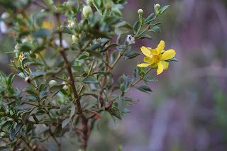
Creosote has little leaves shaped sort of like thyme, and stylish golden yellow flowers, and - to me, most strikingly, amazing little fuzzball seeds. Why wasn't everyone talking about this plant with the fuzzball seeds? It was everywhere.

When I finally understood, I felt like a bit of a muppet (again.) (Also did that just now as I realised it's also the same thing as greasewood. Gah there is so much to learn!)

And weirdly, two of the signature plants of this kind of desert, sagebrush and creosote, both have species names 'tridentata'. Coincidence? Hmmmm.


Saturday, June 11, 2016

HHR Harry


This is Harry. You're a Chevy, Harry. HHR, therefore Harry.
Get it? Don't worry.


Sometimes he is also Dirty Harry.


Harry likes to help us with helpful messages.
Thanks, Harry.


Harry loves adventures ...


But he's not really a rough road vehicle. When we take him on rough roads he feels ... harried.

You're welcome.


Friday, June 10, 2016

Springs and the Calligraphy Highway pt 4 (Really? 4?): Calculating Pie

Okay it's officially the Weekend that Would Not End. Did we really do all this stuff in two days? Brain hurts just thinking about it and carpal tunnel syndrome on the horizon.

After our sobering visit to the Meadow Mountains site, we continued south down the valley. We were on the way home, but by no means finished yet. I'd seen Gunlock Reservoir and State Park on the map, it was over 110 degrees and we thought a swim would be all right. So, turning off at Veyo, down the 3184 - ooh, 4 digit road - we were bound.

But we got a bit side tracked by a sign about pies (that this can happen explains a lot about us.)

And not just a sign, but an actual pie bakery. It was too much to hope that there might be proper meat pies like at home, but the coincidence was too much to ignore. With a nod to the great Viands bakery in Kihikihi, we felt we really should stop at Veyo Pies. (Check their website. Many gifs.)

Pros:

  • Pies, obviously
  • Both start with V
  • Both at the turnoff to expected awesomeness with swimming above a dam
  • Hungry
  • Is that guy on the bench there actually real or one of those very lifelike porch dummies? (He smiled back at me, so I'm going with 'real'.)

Cons:

  • Yeah, hurry up so I can lock the car. It's hot out here.
Result:
  • They have a volcano pie.
  • Yes, a volcano pie. It is chocolate pudding and caramel and cream. Though I think I preferred the sour cream and lemon pie.

At Gunlock we picnicked in questionable shade and made coffee in the crazy heat - I'll post more some time about my wonderful stove - gotta have coffee with your pie. Then walked across the dam to an orange sand beach and oh yes that water was not boiling, not even once you were in.

But the pleasures of more eroded sandstone were still in wait. We continued down the gorge of the Santa Clara, through the extremely lovely Shivwits Paiute land, and around east towards St George, to find further wonders:

How had I never heard about this?
These sandstone cliffs are stunning. I have never heard anyone mention them, never really seen them in guidebooks. It's amazing to live in a region where something this exquisite is no special cause for comment. 

If this weren't enough for a sense of perspective ... we proceeded through charming, historical, Santa Clara town (once a separate place, now part of the ever-spreading urbanosis that is St George) to this stop that Simon wanted to make and I happily seconded: Tuacahn Performing Arts High School and its astounding amphitheatre. You have to ask yourself, how confident would a performer need to be to have this as a backdrop?


And finally, a run down through the wild and scenic Beaver Dam Wash, a brief stop at quirky Beaver Dam AZ for iceblocks and cold drinks ... and on down the I15.

Coming down the interstate, you crest a gentle rise of land and Las Vegas is suddenly revealed, wrapped in the milky, fine, and alkaline dust of a million years of erosion, evaporation, wind blowing over desert. The towers and strange shapes in that soft light are like a dream half remembered, or a memory half dreamed. 

Yeah, we're nearly home.    

Itinerary

Sunday: Meadow Mountains Historical Site Overlook, Turn right onto 3184 at Veyo, Gunlock State Park, Kayenta, Tuacahn, Beaver Dam, Las Vegas.